Climbing Mount Hood
The South Side route, step by step
The South Side is the standard route. The sections below follow the USFS route description and The Mountaineers route page.
- Register at Timberline. The USFS states that "Climbers Registration is in the Wy’East Day Lodge at Timberline." The registration areas also hand out the human-waste pack-out bags the permit requires.
- Timberline to the Silcox Hut. From the Salmon River parking lot, the USFS describes a walk up the gravel service road to "the Silcox Hut, at 7,000’", then a climbers’ trail along the eastern ski-area boundary.
- The Palmer Glacier. Above the hut the route climbs the Palmer Glacier, the snowfield that carries the summer ski lift, whose top at 8,540 ft is the ski area’s highest operating point according to Timberline.
- Triangle Moraine and Crater Rock. The route continues past the Triangle Moraine to Crater Rock. The USGS describes Crater Rock as the surviving remnant of a lava dome from the Old Maid eruptive period of about 1781.
- The crater and the Hogsback. The Hogsback is a snow ridge "in the south side crater area", per the USFS, flanked by fumaroles in the Devil’s Kitchen and Hot Rocks areas. Near its top is the bergschrund, the gap where the moving glacier pulls away from the steeper snow above.
- Old Chute or Pearly Gates. The final pitch runs through one of these two gullies to the summit ridge. The Mountaineers note that the Old Chute route "involves a steep 50° chute".
The Mountaineers give the route as 5,235 ft of gain and 8.0 miles round trip. One guide service describes a 4 to 5 hour ascent and a 4 to 5 hour descent measured from the Silcox Hut; that is a single source, and real times depend on the party and the snow. The how long to climb page and climb in one day page go further.
Why the start is so early
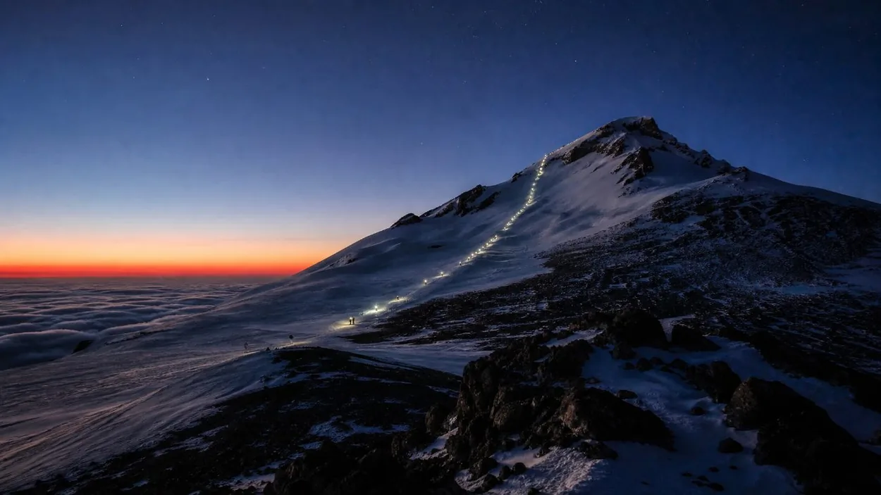
The Mountaineers suggest "an early start (12 am or 1 am)", and guided climbs start "around midnight from the Climber’s Register". The USFS gives the reason in its conditions report: start very early "with a goal of getting up and back down from overhead hazard zones like the Old Chute area before they’re in the sun". Sun loosens rock and ice held in place by the overnight freeze. A fixed turnaround time is a common mountaineering practice rather than a USFS rule; the two pm rule page explains the idea.
Hazards named by the USFS
The USFS climbing page lists six hazards for the climb:
- Avalanches.
- Climber congestion.
- Glacial features and fumarole holes, including crevasses, the bergschrund and the "deep holes and cracks in the snow" around Devil’s Kitchen and Hot Rocks.
- Icefall and rockfall, the reason for the early start described above.
- Long sliding falls.
- Weather.
The safety page and the crevasses page look at these in more detail.
Season and the 2026 statement
The best conditions are in spring to early summer, according to Mt. Hood Territory, and The Mountaineers give May and June for the standard route. The USFS publishes climbing condition reports on Tuesday and Friday mornings "through early summer".
In late summer 2026 the USFS published a statement that "Climbing rangers no longer recommend attempting a summit climb in the 2026 season due to significantly elevated mountain hazards", adding that "Rockfall will be your primary hazard on the upper mountain this time of year". Regular condition reports resume in spring 2027. The best time to hike page sets the climbing season beside the hiking one.
Preparation
The route is graded as a glacier climb, so the preparation is that of a glacier climb: fitness for a long night and day at altitude, and the skills to use crampons and an ice axe, including stopping a slide on steep snow. Long trail days on the mountain’s flanks, such as Cooper Spur or other day hikes, are a way to build fitness at elevation. The what to pack page lists gear, and can beginners climb covers the step up from hiking.
The old Mountain Locator Units, radio beacons once rented for the climb, were discontinued in 2017. Some route pages still mention renting them. Climbers now carry a personal locator beacon (PLB) or a satellite messenger instead.
Permit, guides and numbers
A Mt. Hood Climbing Permit is required for all travel above 9,500 ft. It is bought on recreation.gov, a fee applies, and it cannot sell out; the climbing permit page covers the rules. The USFS says there are guides for "summiting the mountain", operating under USFS permits, and that it is not accepting new proposals to guide in the Mount Hood Wilderness. Guided climbs are not sold on GetYourGuide; do you need a guide weighs the question.
The USFS says "Every year thousands of people climb Mt. Hood", and the figure of up to about 10,000 a year appears in reporting of a USFS reminder. The how many people climb page explains the numbers. The first recorded ascent was on 11 July 1857, by Henry Pittock’s party.
The USFS climbing conditions report, posted on Tuesday and Friday mornings in season, is the place to check the route before registering at the Wy’East Day Lodge.
Seeing the summit route without climbing
No climb is bookable on GetYourGuide. For a look at the upper mountain from above, the Portland: Flightseeing Tour Mount Hood is a 1-hour airplane flight from Troutdale, according to its listing, with a route "subject to change at pilot’s discretion" and dependent on weather. Weight limits apply per the listing.
Frequently asked questions
Can you climb Mount Hood without experience?
The route is graded "Grade II, Class 3 glacier climb" by The Mountaineers, and the USFS lists avalanches, crevasses, fumarole holes, rockfall and long sliding falls among its hazards. See can beginners climb.
What time do climbers start on Mount Hood?
Usually around midnight to 1 am from Timberline, so that parties are off the Old Chute area before the sun reaches it. The how long to climb page has the timings.
Do you need a permit to climb Mount Hood?
Yes. A Mt. Hood Climbing Permit is required for all travel above 9,500 ft, bought on recreation.gov. See the climbing permit page.
Are Mountain Locator Units still available?
No. They were discontinued in 2017. Climbers carry a PLB or a satellite messenger instead. The safety page has more.