Can You Hike Mount Hood?
What the Forest Service says
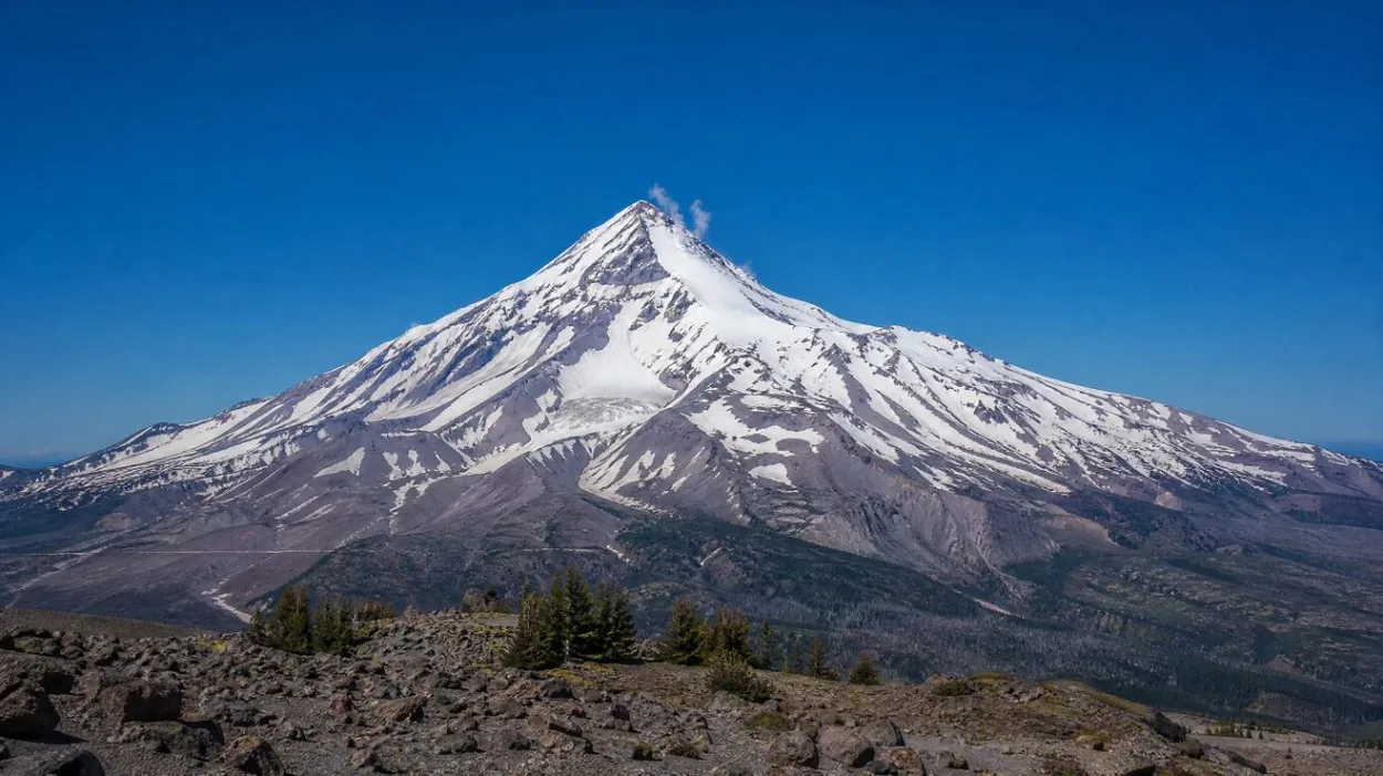
Mount Hood is the highest point in Oregon. The USGS and the USFS give its height as 11,240 ft; a 1991 survey gives 11,249 ft, the figure some tour listings print. It stands about 60 road miles east of Portland, a drive of 70 to 90 minutes via I-84 and US-26 according to Travel Portland.
The Mt. Hood National Forest does not describe the summit as a hike at all. Its climbing page states that "Mt. Hood is a technical climb - there are no trails to the summit", and it requires a Mt. Hood Climbing Permit "for any travel above 9,500 ft. elevation". The USFS climbing page lists the hazards: avalanches, climber congestion, glacial features and fumarole holes, icefall and rockfall, long sliding falls, and weather. Those are the conditions of a mountaineering route, not of a trail.
Three things "Mount Hood hike" can mean
The phrase covers three different trips, and only one of them is a hike.
- The summit climb. A glacier climb from Timberline Lodge, usually started around midnight, with a paid permit above 9,500 ft. The climbing page describes the South Side route.
- A hike on the flanks. Trails below the glaciers, from a 2-mile lake loop to a multi-day circuit. The day hikes page lists them with distances and passes.
- A day trip that stops at the mountain. The tours sold online from Portland are sightseeing days with a stop at Timberline Lodge, not hikes. The hiking tours page explains what they include.
How high a hiker can go
On foot and on a trail, the ceiling is Cooper Spur on the north-east side. The USFS describes the lower Cooper Spur loop as "only a 3 mile loop, and moderately strenuous". Hikers who continue up the spur reach a high point of about 8,510 ft near Tie-In Rock, a trip of about 7.1 miles round trip with 2,680 ft of gain, according to Oregon Hikers. Oregon Hikers, the Mazamas and other hiking guides call it the highest point on the mountain reachable by trail; the USFS does not make that claim itself. The trailhead is at Cloud Cap, 5,850 ft, and the USFS notes that Cloud Cap Road is usually snowed out until late June or July. The Cooper Spur page has the details.
From Timberline Lodge, at about 6,000 ft on the south side, the Mountaineer Trail climbs to the Silcox Hut at 7,000 ft. The Magic Mile Sky Ride reaches the same height in summer without skis, according to Timberline; it was closed for the season as of late September 2026. The top of the Palmer lift, at 8,540 ft, is the ski area’s highest operating point, per Timberline. Above that lies the permit line at 9,500 ft, and above that the climb.
Where the hike ends and the climb begins
The standard South Side route gains roughly 5,200 ft from Timberline. The Mountaineers grade it "Grade II, Class 3 glacier climb" and suggest "an early start (12 am or 1 am)". The line runs up the Palmer Glacier to the Triangle Moraine and Crater Rock, then along the Hogsback ridge in the crater and through the Old Chute or the Pearly Gates to the summit. The USFS names fumarole holes in the Devil’s Kitchen and Hot Rocks areas that open "deep holes and cracks in the snow", and a bergschrund below the summit.
The climb also has a season. The USFS and Mt. Hood Territory point to spring and early summer; The Mountaineers give May and June. In late summer 2026 the USFS climbing rangers stated that they "no longer recommend attempting a summit climb in the 2026 season due to significantly elevated mountain hazards", with rockfall the main hazard on the upper mountain. The climbing permit page, can beginners climb and do you need a guide cover the next questions.
The trails that are hikes
Below the glaciers the mountain has a long list of maintained trails, each with its own pass rule. A few starting points, with USFS figures unless stated:
- Mirror Lake: 1.9 miles to the lake with 460 ft of gain, from a trailhead 0.4 miles west of Government Camp on US-26.
- Trillium Lake: a 2-mile loop built to be barrier free, around a 63-acre lake below the south face.
- Ramona Falls: 7 miles round trip with about 1,000 ft of gain and a ford of the Sandy River, which has no bridge.
- Zigzag Canyon: an out-and-back from Timberline Lodge on the Pacific Crest Trail, 4.4 to 5.4 miles round trip depending on the hiking guide.
- The Timberline Trail: about 40 miles around the mountain, which the USFS says most backpackers take 3 or 4 days to complete.
Passes differ from one trailhead to the next; the passes and permits page sorts them out, and the best time to hike page covers snow and meltout. Wildfires closed a number of trails on the east side of the mountain in late summer 2026; check the Mt. Hood National Forest alerts page before setting out.
What can be booked online
None of the six GetYourGuide products on this site is a guided hike or a climb. According to their listings:
- The Portland: Mt. Hood Day Tour gives Timberline Lodge 30 minutes of "free time, hiking, self-guided tour" inside an 8.5-hour day.
- The Columbia Gorge Waterfalls and Mt. Hood Tour gives Timberline 40 minutes, and its listing states a "maximum typical walk distance: ½ mile round trip".
- The Waterfalls, Mt Hood, and Wine Day Tour gives Timberline 30 minutes after a winery stop.
- The Full Day Gorge Waterfalls & Mt. Hood Tour lists a visit to historic Timberline Lodge; the stop length is not stated in the captured itinerary.
- The Mt Hood & Columbia River Private tour gives Timberline 1.5 hours.
- The Flightseeing Tour Mount Hood is a 1-hour airplane flight over the mountain.
Guided summit climbs do exist, run by guide services that hold USFS special use permits, but they are not sold on GetYourGuide. Hood River, a stop on several of these tours, is a city on the Columbia River north of the mountain, not a place on Mount Hood itself. The which tour page sets the six products side by side.
For a first look at the upper mountain without a permit, the walk from Timberline Lodge to the Silcox Hut at 7,000 ft stays on the ski area side of the permit line. Snow can linger there well into summer.
A day at the mountain without driving
No hike or climb is bookable through the widget below. It is for the Portland: Mt. Hood Day Tour, a day trip with hotel pickup in central Portland, stops in the Columbia River Gorge and Hood River, and 30 minutes at Timberline Lodge, according to its listing.
Frequently asked questions
Is there a trail to the top of Mount Hood?
No. The USFS states that "Mt. Hood is a technical climb - there are no trails to the summit". A paid climbing permit is required above 9,500 ft. The climbing page describes the route.
What is the highest point you can hike to on Mount Hood?
Hiking clubs name the Cooper Spur area, at about 8,500 ft (Oregon Hikers gives 8,510 ft). See the Cooper Spur page.
Can you walk from Timberline Lodge?
Yes. Trails from the lodge lead to the Silcox Hut at 7,000 ft and west along the Pacific Crest Trail to Zigzag Canyon. The USFS says no recreation pass is needed to park at Timberline in summer.
Do any Mount Hood tours include a hike?
None of the six GetYourGuide products is a guided hike. The Mt. Hood Day Tour listing gives 30 minutes of "free time, hiking, self-guided tour" at Timberline. The hiking tours page has more.